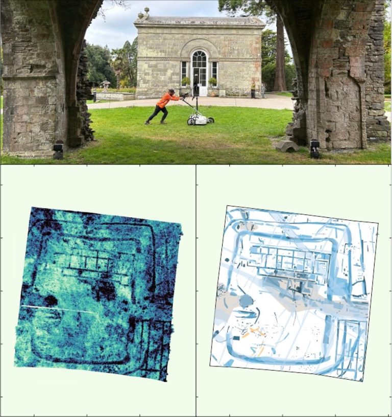
TerraDat (UK) Ltd. – Geophysical Survey Company

TerraDat Services and Applications

Shallow Geophysics for Transmission Cable Route Characterisation

Shallow geophysics plays a crucial role in characterizing the subsurface for transmission cable routes, offering significant advantages to transmission teams working on energy infrastructure projects. By employing non-invasive geophysical techniques, energy providers can optimize cable route planning, reduce environmental impact,

Read More...
brownfield geophysics

Brownfield Site Investigation using Geophysics

Most former industrial sites have a legacy of buried structural hazards and contamination. Geophysical surveys can detect buried targets without the need to excavate. Many industrial contaminants, such as salinisation by acids and hydrocarbon plumes, can leave a significant geophysical

Read More...

Crosshole Seismics

Seismic methods can provide detailed information about rock properties and geological structure between boreholes. Fewer boreholes are needed to achieve a continuous picture of the subsurface, thereby reducing overall costs and the risk of missing target features. Borehole seismic methods

Read More...
TerraDat provides expert geophysical survey services for both active and closed landfill sites.

Characterisation of Landfill Sites using Geophysics

Addressing the growing challenge of environmentally compliant landfill management, TerraDat provides expert geophysical survey services for both active and closed landfill sites. Our advanced, non-invasive techniques deliver high-resolution insights into landfill composition and boundaries, surpassing traditional methods in efficiency and

Read More...
Survey image

Ground Conductivity (EM)

A ground conductivity or electromagnetic (EM) survey involves the generation of an EM field at the surface and subsequent measuring of the response as it propagates through the subsurface. The main components of the instrument are a transmitter coil (to

Read More...
Magnetics

Magnetics

The magnetic survey technique is based on mapping localised variations in the Earth’s magnetic field caused by sub-surface magnetic materials, which range from naturally occurring magnetic minerals to man-made ferrous objects. This leads to a wide range of applications, from

Read More...
example of a team undertaking a seismic refraction survey

Specialist Seismic Refraction Survey Company

TerraDat is a specialist Seismic refraction survey company with many years of experience applying and researching its use in shallow engineering and geotechnical work. Seismic survey methods provide a useful tool for investigating geological structure and rock properties. The technique

Read More...
Ground-Penetrating-Radar

Experienced Ground Radar (GPR) Company

TerraDat has been a GPR survey company since the technique evolved to a level where it could be applied to a wide range of applications over 20 years ago. Because the GPR method involves analysis of wave-form data, our experience

Read More...
Electrical Resistivity survey

Electrical Resistivity Tomography (ERT)

The Resistivity technique is useful for characterising the sub-surface materials in terms of their electrical properties. Variations in electrical resistivity (or conductivity) typically correlate with variations in lithology, water saturation, fluid conductivity, porosity and permeability, which may be used to

Read More...
TerraDat's UAV LiDAR system in operation — capturing dense point clouds for terrain modelling and archaeological interpretation

Aerial LiDAR Survey & UAV Mapping Services

TerraDat has been mapping the world in three dimensions since the earliest days of close-range photogrammetry and terrestrial laser scanning. As drone technology matured, we were at the forefront of integrating airborne LiDAR — and today our UAV-mounted sensor represents

Read More...